'Australian Postcode Maps'

Select the postcode footprint to view what area is covered with a postcode.

Free to download any individual map just select the area you want, or go straight to the postcode to filter on.

I located a file that enabled me to link the shape files to actual useful data. 

Matthew Proctor, https://www.matthewproctor.com/australian_postcodes

Has graciously provided this data set for free as Australia Post charges for this information, he has noted that there are possible errors in the merging of data locations, so I am paying this forward, and asking that if you see errors can you please contact me through my 

                                 ‘Data Modelling Suggestions’

page and I will correct the data set that is attached to the mapping coordinates.


Victorian Postcodes & Population Estimation Growth (2023 - 2028)

This dashboard you have the opportunity to highlight a Federal Electoral Boundary and gain insights into the increase in population in your postcode.

Note:  The forecasts are a data set that the AEC website made available for the 2023 Redistribution of the Electoral Boundaries.  They also noted that the ABS had incorrectly predicted some of the area, but stated that this would not interfere with the upper and lower bounds of the Redistribution criteria, therefore by assumption that the differences were not significant to provide a new data set for the redistribution process.

I have combined Matthew Proctors data set with the ABS data Set for this dashboard.  Again if there are errors in the localities please contact me by the ‘Data Modelling Suggestions’ page and I will update the dataset.

Thank you 

Shandra


Scroll down for the 'Interactive Dashboards' to start digging!

Download & Print
your selections Instructions.

There is two ways that you can find your streets SA1 neighbourhood code.

Filter

  • Select your SA4
  • Select your SA3
  • Select your SA2
  • A list of SA1 codes is on your screen now
  • Zoom in to find your street and take note of your neighbourhood SA1

Simply just Zoom into the map and locate your neighbourhood’s SA1 code

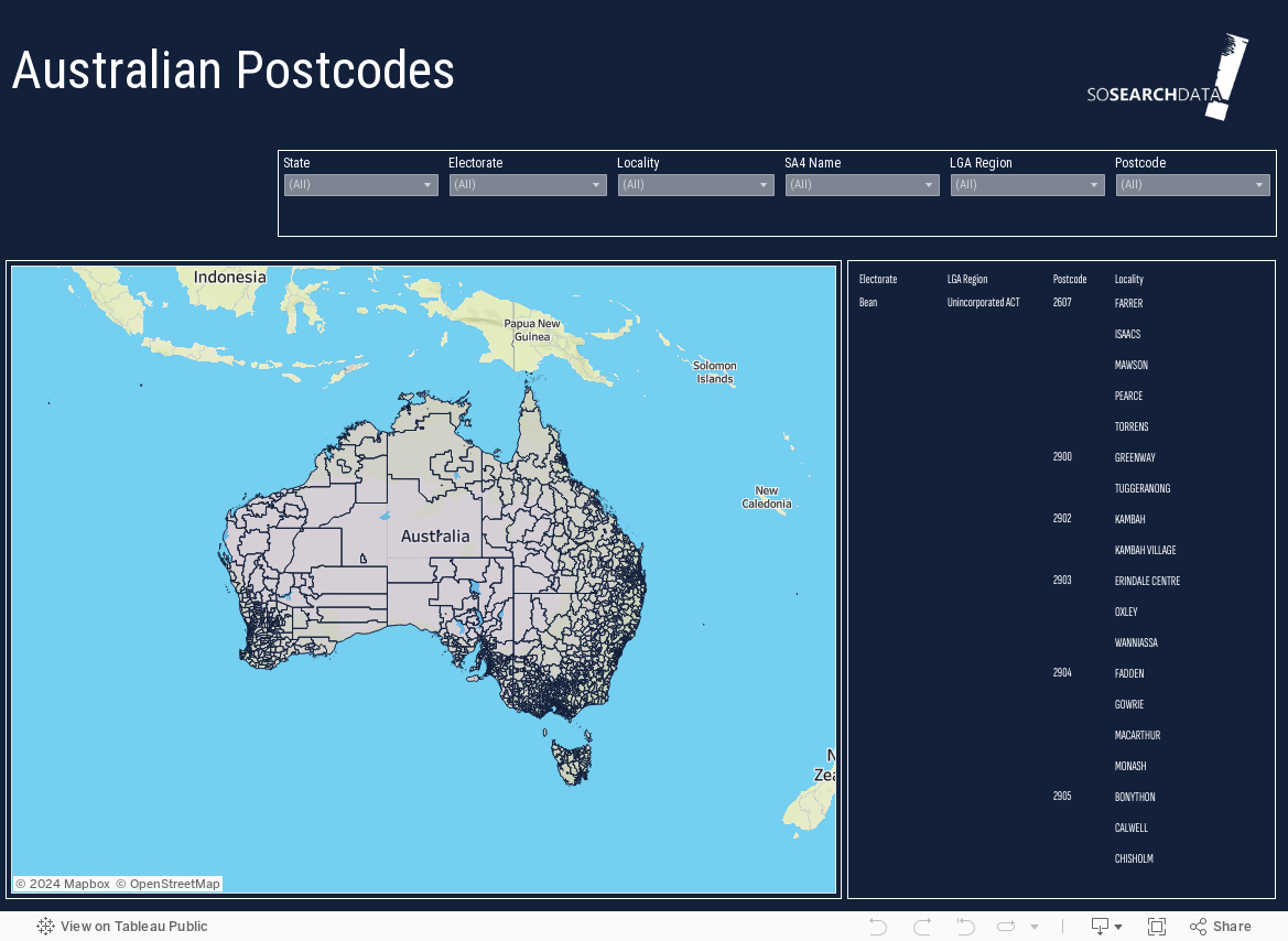
If you want to change the map area you will need to remove all of the filters you have applied.

To do this you need to:

Mouse over the filter slowly to the top right hand side.

A grey filter icon appears and if there is any conditions applied there will be a red (X).

Click on this red (X) to remove the filter and ensure that SA1, SA2, SA3, SA4 do not have a red (X).

You will then be able to view all areas to begin another area analysis

The bar at the bottom of the interactive dashboard on the right hand side has a downward arrow.  #Click this and a pop up window appears. 

  • Select PDF.
  • Include:  This View
  • Page Size:  A4
  • Orientation:  Horizontal

Select: Download to create the PDF.

www. abs.gov.au/statistics/standards/australian-statistical-geography-standard-asgs-edition-3/jul2021-jun2026/main-structure-and-greater-capital-city-statistical-areas/statistical-area-level-3

Verified by MonsterInsights